You’re standing at the edge of the asphalt in Ballston Spa, wondering if you actually parked in the right spot. Honestly, it’s the most common "Zim Smith" experience there is. Most people think there's just one main Zim Smith trail head, but this 11.5-mile ribbon of pavement through Saratoga County is way more decentralized than that. If you just GPS "Zim Smith Trail," you might end up behind a Stewart’s or staring at a dead-end residential street.
The trail itself is a legend in New York. It’s the only one in the state designated as a National Recreation Trail by the National Park Service. It’s smooth, mostly flat, and cuts through some of the most beautiful "secret" wetlands and forests in the Capital Region. But finding the right starting point depends entirely on whether you want a quiet nature walk, a long-distance bike ride, or a place where your kids can melt down at a playground five minutes into the trip.
Finding the Right Zim Smith Trail Head
Let’s talk logistics. You have four or five "real" starting points, and each one has a completely different vibe.
The northernmost Zim Smith trail head is on Oak Street in Ballston Spa. It’s tucked away. You basically drive past the Saratoga County fairgrounds and look for a small gravel-ish area. If you start here, you’re hitting the most "industrial" feeling part of the trail first, but it quickly opens up into deep woods. It’s about 11.6 miles from here to the other end in Mechanicville.
If you’re looking for the best all-around experience, head to Shenantaha Creek Park in Malta. Most locals consider this the "true" hub. You get actual bathrooms—not just a plastic blue box—and a massive parking lot. The trail bisects the park, so you can head north toward Ballston Spa or south toward Round Lake. Plus, there’s a bike repair station right by the path. Pretty handy if you realize your tires are soft the second you take the bike off the rack.
The Round Lake Connection
Then there's the Village of Round Lake. This is where things get pretty. You can park near Curry Avenue or the village playground. This section is iconic because of the Victorian "gingerbread" houses and the massive Round Lake Auditorium. It’s a great spot to start if you want to ride a few miles and then immediately eat a sandwich or grab a coffee at Leah’s Cakery. Just be careful with the crossing at Goldfoot Road; cars fly through there sometimes, even though there’s a clear crosswalk.
The Southern End: Coons Crossing and Mechanicville
The southern stretch has seen the most change lately. For years, the trail basically died in the middle of the woods at Coons Crossing Road. Now, it’s fully paved all the way into the City of Mechanicville.
- Coons Crossing Lot: Located in Halfmoon, this is a massive paved lot. It’s the quietest section.
- Elizabeth Street Ext: This is the newest southern terminus. You’re basically in Mechanicville here, right near the active Pan Am Southern railyards. If you like trains, start here. The sound of the locomotives idling is a constant backdrop.
Why This Trail Actually Matters (And It's Not Just the Pavement)
The Zim Smith isn’t just some random path built for the sake of it. It follows the old Delaware & Hudson Railroad line. Specifically, parts of it date back to the Rensselaer & Saratoga Railroad from 1836. That's old. Like, "pre-Civil War" old.
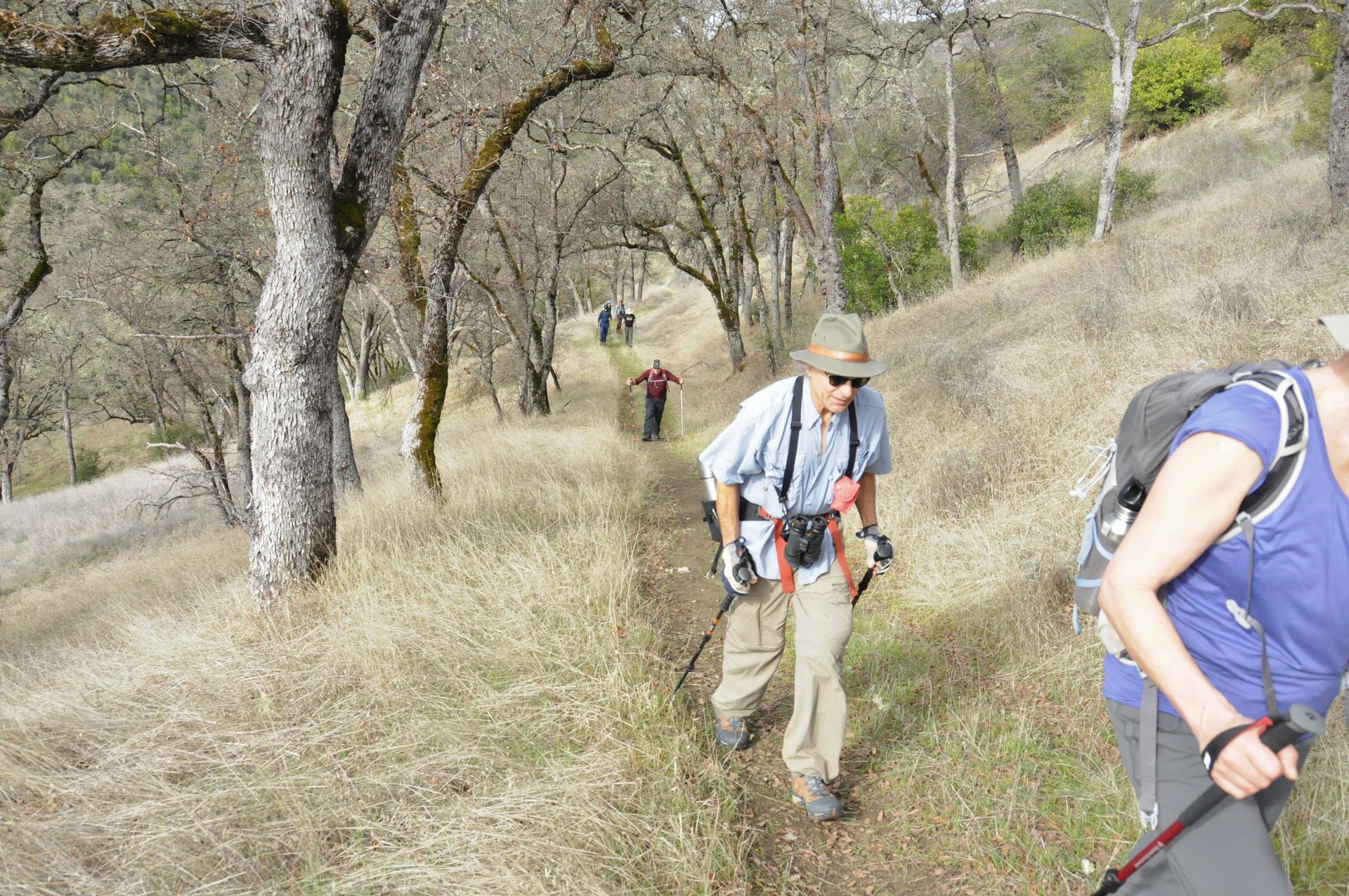
When you’re walking the section between Malta and Round Lake, look for the old stone culverts and the way the land is graded. It’s perfectly level because trains can't handle steep hills. This makes it a godsend for anyone who hasn't been on a bike in ten years. You won't find any "heart-attack hills" here.
There’s also some pretty cool engineering involved. The trail carries you over Route 9 on a massive old railroad bridge and tucks you under I-87 (the Northway). There's a specific moment when you're under the highway where the roar of the cars is deafening, and then ten seconds later, you're back in total silence in the woods. It’s a weird, cool contrast.
The "Secret" Extensions and What’s Coming in 2026
Saratoga County isn't done with this thing. There is currently a major push to extend the trail even further north. The "missing link" has always been connecting Ballston Spa to Saratoga Spa State Park.
As of early 2026, the planning for the northern extension is well underway. The goal is to add about 4 miles of new trail, crossing the Kayaderosseras Creek with a new bridge and ending near East West Road in the State Park. Once that’s done, you could technically bike from the Mechanicville docks all the way into the heart of Saratoga Springs without ever sharing a lane with a car. That’s a game-changer for regional tourism.
Practical Tips for Your First Trip
Don't be the person who shows up unprepared. Here’s the "friend-to-friend" advice:
- The Wind Factor: Because the trail is an old rail corridor, it’s very straight. This creates a wind tunnel effect. If you’re biking south from Ballston Spa, you might have a brutal headwind the whole way back. Check the weather.
- Cell Service: It’s mostly fine, but there are "dead zones" near the wetlands between Malta and Round Lake. Don't rely on a live map; download it first.
- The "Stewart's" Hack: There is a Stewart’s Shops right off the trail at the intersection of Route 67 and Underpass Road. You can actually see it from the path. It’s the unofficial pit stop for every cyclist in the county.
- Benches: There are two specific benches between Ruhle Road and Shenantaha Creek Park that overlook small waterfalls. They are almost always occupied, but if they’re empty, sit down. It’s the best view on the whole 11 miles.
If you’re planning to visit, start at Shenantaha Creek Park for your first time. It’s the easiest point of entry and gives you the best sense of what the trail is all about. From there, you can decide if you want to push all the way to the Mechanicville railyards or just cruise into Round Lake for a cupcake.
Your next move: Download the Saratoga PLAN trail map to your phone. It shows the exact GPS coordinates for the Oak Street and Coons Crossing entrances, which can be tricky to find using standard Google Maps. Once you've got the map, check your tire pressure and aim for a mid-morning start to beat the afternoon wind.