The structural failure of 13 buildings and the forced displacement of 7,000 citizens in Liuzhou following a modest 5.2-magnitude earthquake exposes a critical flaw in regional seismic risk modeling. Standard disaster reporting focuses on the emotional toll of displacement and casualty counts. A rigorous engineering and economic analysis reveals that the true crisis lies in the vulnerability profile of low-to-moderate seismicity zones, where building codes, shallow hypocenters, and specific geological terrains intersect to amplify structural damage far beyond theoretical projections.
When a shallow 8-kilometer hypocenter discharges energy directly beneath an industrial hub, the resulting peak ground acceleration overrides standard building tolerances. The event in Guangxi demonstrates that seismic risk is not merely a function of magnitude, but a variable dictated by local geotechnical conditions and asset depreciation.
The Tri-Factor Vulnerability Framework
Evaluating the impact of the Liuzhou seismic event requires analyzing three distinct operational variables that converted a moderate tremor into a systemic localized disruption.
1. The Shallow Focal Depth Vector
The primary driver of the structural damage was the earthquake’s hypocentral depth of 8 kilometers. In seismology, the attenuation of seismic energy is inversely proportional to the distance from the rupture zone.
- Shallow Crustal Ruptures (0–70 km): Energy traveling through a mere 8 kilometers of the earth's crust undergoes minimal geometric spreading and material damping. The body waves ($P$-waves and $S$-waves) arrive at the surface with near-maximum kinetic energy, transforming instantly into destructive high-amplitude surface waves (Rayleigh and Love waves).
- Deep Focus Counterparts: A 5.2-magnitude event at a depth of 50 kilometers distributes its vibrational energy across a vastly larger volume of rock, resulting in low peak ground acceleration (PGA) by the time the wavefront reaches the surface. In Liuzhou, the compact distance preserved the high-frequency vibrations that specifically target low-rise, rigid masonry structures.
2. Karst Geomorphology and Ground Motion Amplification
Liuzhou is situated within the limestone karst terrain characteristic of southern China. While karst topography is defined by its dramatic surface features, its subsurface composition is highly irregular, punctuated by subterranean drainage networks, caves, and varying thicknesses of unconsolidated alluvial topsoil.
This geological profile creates a secondary hazard known as the site amplification effect. When seismic waves transition from dense, deep-seated bedrock into loose, water-saturated alluvial soils or pass through cavernous limestone voids, the velocity of the waves decreases. To conserve energy flux, the amplitude of the seismic waves must increase sharply. This mismatch in impedance acts as a physical amplifier, causing the soft upper soil layers to shake with significantly greater intensity and duration than the underlying bedrock.
3. Structural Masonry Deficiencies
The collapse of 13 buildings and the cracking of dozens more point directly to unreinforced masonry (URM) vulnerabilities. In regions classified historically as low-to-moderate seismic risks, older residential and commercial structures are frequently built using concrete block or brick masonry without internal steel reinforcement.
URM structures possess high compressive strength but virtually zero tensile strength or ductility. When subjected to the horizontal shearing forces of an earthquake’s $S$-waves, these buildings cannot deform elastically. Instead, they experience brittle failure, typically manifesting as diagonal "X-cracking" in load-bearing walls, followed by the catastrophic loss of vertical load capacity.
Post-Event Operational Log
The stabilization of the Liuzhou municipal area post-rupture highlights the efficiency of localized, high-density emergency deployment, while revealing vulnerabilities in regional supply chain infrastructure.
[00:21 AM] ---- 5.2 Magnitude Rupture (8km Depth)
    |
    |-- [Immediate] ---- Rapid Deployment: 51 Vehicles / 300+ Personnel
    |
    |-- [02:00 AM] ----- Precautionary Evacuation of 7,000 Residents
    |
    |-- [06:00 AM] ----- Rail Infrastructure Halt & Structural Inspections
    |
    +-- [12:00 PM] ----- Extraction of 91-Year-Old Survivor / Search Phase Closure
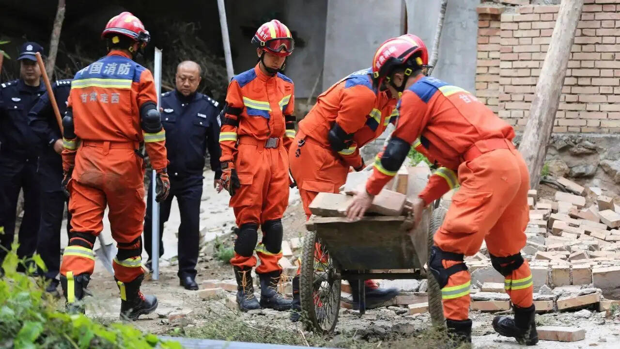
The mobilization of 51 specialized fire and rescue vehicles alongside more than 300 professional personnel indicates a pre-staged municipal response capability designed for rapid urban intervention. The immediate evacuation of 7,000 citizens from high-risk perimeters serves as a vital safeguard against structural failure during aftershocks. Because a compromised building's structural integrity degrades during the initial shock, subsequent low-magnitude aftershocks can trigger the collapse of structures that survived the primary event.
The primary structural vulnerability discovered during the rescue phase was concentrated in the Liunan district, where older structural assets are densest. The successful extraction of a 91-year-old survivor from structural debris approximately twelve hours post-quake marked the operational transition from active search-and-rescue to structural remediation and civil engineering verification.
Civil Infrastructure Bottlenecks
While state media confirmed that primary utility lines—including electrical grids, municipal water systems, gas pipelines, and digital communication networks—remained operational, transportation networks suffered immediate performance degradation.
Railway authorities implemented an immediate operational hold across the Liuzhou transit network. This protocol is mandatory because railway tracks are highly sensitive to lateral alignment shifts and subgrade deformation caused by seismic shaking. A 5.2-magnitude shallow quake can induce rail buckling, track displacement, or hidden damage to bridge abutments and overpasses that cannot be diagnosed via automated systems.
Manual track inspections and structural integrity validations create an immediate logistics bottleneck, delaying the movement of both passengers and commercial freight through a vital manufacturing corridor. Furthermore, localized landslides triggered by the shaking blocked secondary roadways, restricting access to outlying villages and shifting the entire logistical burden onto primary highway infrastructure.
The Economic Reality of Seismic Upgrades
The structural failures in Guangxi expose the fiscal challenges of retrofitting legacy building stock. Municipalities face a difficult trade-off between the upfront costs of structural mitigation and the long-term expenses of disaster recovery.
$$\text{Total Structural Risk} = \text{Hazard Probability} \times \text{Vulnerability Factor} \times \text{Asset Value}$$
In high-risk tectonic zones like Sichuan or Taiwan, strict adherence to high-ductility engineering standards is economically justified by the high probability of major seismic events. In low-to-moderate risk zones like Guangxi, justifying the capital expenditure required to retrofit millions of square meters of unreinforced masonry is more difficult.
Retrofitting techniques—such as installing external steel bracing, applying carbon-fiber-reinforced polymer (CFRP) wraps to columns, or implementing base isolation systems—carry high capital costs per structure. For an industrial economy like Liuzhou, a blanket mandate for immediate seismic retrofits would divert billions in capital away from industrial optimization and municipal development.
The strategy must instead pivot to targeted engineering interventions. Municipal authorities should use geographic information systems (GIS) to overlay local karst soil amplification maps onto building age data. This approach allows cities to identify and prioritize the most vulnerable structures—such as pre-1990s unreinforced masonry buildings housing high-density populations—maximizing the lifesaving impact of limited engineering budgets.
Structural Remediation Directives
Municipal governance and urban planning departments must transition from reactive crisis management to structured structural hardening.
- Mandate Microzonation Studies: Standard regional seismic hazard maps are too broad to account for localized karst amplification. Cities must conduct high-resolution seismic microzonation to map soil shear-wave velocity ($V_{s30}$) and subsurface voids, integrating these findings directly into municipal zoning laws.
- Implement Trigger-Based Retrofit Ordinances: Rather than demanding immediate, cost-prohibitive city-wide retrofits, establish policies that mandate seismic upgrading whenever an older building undergoes significant structural renovation, ownership transfer, or change in occupancy use.
- Deploy Automated Rail Shut-Off Systems: Upgrade regional transit networks with accelerometer-linked automated braking systems. These systems detect the initial, less destructive $P$-waves and automatically halt rail traffic before the highly damaging $S$-waves and surface waves hit vulnerable track segments.


